Future Stirling
Reviewing the Strategic Community Plan to guide the City’s long‑term direction.
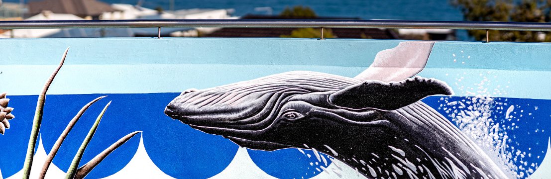
The local community describes Watermans Bay as a seaside, small and peaceful neighbourhood. To better understand what is means to be ‘a local’ our suburb profile seeks to understand the local stories Koora (past), Yeyi (present), Boordawan (future) and respond to Ngalang Maya (our place). This snapshot identifies the unique character of Watermans Bay’s neighbourhood and helps the City rethink how we deliver services with a local focus.
The suburb of Watermans Bay was originally known as Waterman Bay and named after Alfred Waterman, a fisherman who built the first house in the area (called 'Zephyr') in 1908.
The suburb of Watermans Bay was originally known as Waterman Bay and named after Alfred Waterman, a fisherman who built the first house in the area (called 'Zephyr') in 1908. The bay was a well-known fishing spot. The Postal District of Watermans Bay was approved in 1954 and in 1962 the name "Watermans Bay" was shortened to "Waterman".
Local residents requested that the named be changed back to Watermans Bay in 1964 however the request was rejected because it did not comply with the State Government policy at that time. In 2003 the Trigg, North Beach and Waterman Community Association conducted a survey of residents to determine the level of community support for a change of name. Of the 564 households surveyed, 502 responses were received with 491 in support and only 11 households objecting to the proposal. In November 2003 the State Government's Geographic Names Committee finally agreed to a City of Stirling proposal to change the name of the suburb from Waterman back to Watermans Bay.
Watermans Bay was originally part of the estate that the Hamersley family acquired in 1837. The area was subdivided as the Mt Flora Estates in 1918; however initial development was largely limited to holiday shacks. The pace of growth in Watermans Bay increased after World War II, and by the late 1960s the area had reached its development potential. In recognition of this growth, the townsite was gazetted in 1964. Some redevelopment began in the 1970s, with new homes replacing holiday shacks. Many of the street names in Watermans Bay honour members of the Hamersley family including Ethel, Margaret, Mary and Ada.
These are the top local priorities you've told us are important for Watermans Bay.
"Parking on verges at intersection of Mary Street and Flora Terrace is a major traffic and safety hazard. No parking on verge signs would help on the four corners of that intersection. Street parking is also a major safety issue."
The City has applied for Black Spot funding to improve safety for vehicles and pedestrians at this intersection.
To make a report, call the City's Community Patrol on 1300 365 356 (24/7 services) or report online.
"Safety for walker on the shared path along West Coast Drive."
The City has provided pedestrian crossings at three locations along West Coast Drive and a 40km speed limit has been implemented by MRWA. Outcomes of a review of those crossings will be presented before Council for consideration of two additional crossings at North Beach and Mettams in August 2026.
Learn more about pedestrian safety measures on West Coast Drive.
"Fix the showers at Watermans Bay."
Upgrades to the coastal showers at Watermans Bay were funded through the 2025/26 Capital Works Budget.
"Erosion on Watermans Bay beach."
"Watermans Bay dune restoration, protection and amenity."
In preparation for the CHRMAP, the City consulted extensively with the community and stakeholders to identify high-priority assets and considerations for our precious coastline. The CHRMAP provides strategic guidance for coordinated, integrated and sustainable land use planning and management and is a long-term plan that informs the City’s future decision.
The City engaged a range of specialist advisory services to complete a Coastal Hazard Risk Management and Adaptation Planning (CHRMAP) process.
In March 2026, the City formed a Coastal Protection Working Group with members of the community with a special interest in coastal protection through an Expressions of Interest process. The aim of the newly formed group is to share knowledge about coastal issues and provide a community perspective on coastal protection works.
To find out more visit Coastal Environment and Management.


The suburb of Watermans Bay was originally known as Waterman Bay and named after Alfred Waterman, a fisherman who built the first house in the area (called 'Zephyr') in 1908. The bay was a well-known fishing spot. The Postal District of Watermans Bay was approved in 1954 and in 1962 the name "Watermans Bay" was shortened to "Waterman".
Local residents requested that the named be changed back to Watermans Bay in 1964 however the request was rejected because it did not comply with the State Government policy at that time. In 2003 the Trigg, North Beach and Waterman Community Association conducted a survey of residents to determine the level of community support for a change of name. Of the 564 households surveyed, 502 responses were received with 491 in support and only 11 households objecting to the proposal. In November 2003 the State Government's Geographic Names Committee finally agreed to a City of Stirling proposal to change the name of the suburb from Waterman back to Watermans Bay.
Watermans Bay was originally part of the estate that the Hamersley family acquired in 1837. The area was subdivided as the Mt Flora Estates in 1918; however initial development was largely limited to holiday shacks. The pace of growth in Watermans Bay increased after World War II, and by the late 1960s the area had reached its development potential. In recognition of this growth, the townsite was gazetted in 1964. Some redevelopment began in the 1970s, with new homes replacing holiday shacks. Many of the street names in Watermans Bay honour members of the Hamersley family including Ethel, Margaret, Mary and Ada.
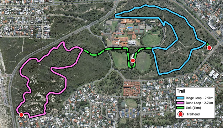
Star Swamp Reserve is of regional significance and occupies a large portion of Watermans Bay. This area provides the local and wider community with a unique recreational area, containing a diverse range of indigenous flora and fauna. The Star Swamp bushland was declared an 'A' Class Reserve by the State Government in 1987 and covers an area of about 96 hectares.
Watermans Bay has 2ha of public open space which includes three small parks and recreation areas, including Watermans Beach and Laurie Strutt Reserve. The latter contains the Water Tower Museum, which is located at the highest point of the suburb and was built in 1940 to provide scheme water to the surrounding areas. After the tank became redundant it was converted to a museum and lookout in 1986 and now details the region's history.
Commercial development in Watermans Bay is limited to a small retail outlet on West Coast Drive that provides convenience goods for local residents. The suburb also contains the Euroka Village, which cares for senior citizens.
Ada Street Beach is located in Watermans Bay and features a shaded play area and water fountains.
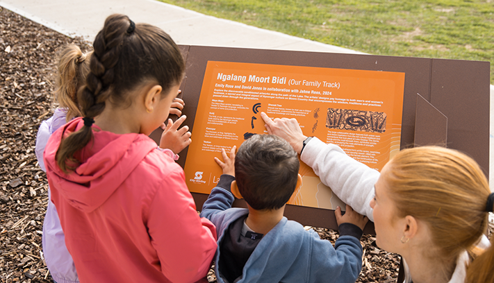
City of Stirling kaadatj Nyoongar moort Nyoongar boodja-k Wadjak boodja-k. Ngalak kaadatj Nyoongar nedingar wer birdiya koora koora wer yeyi. Baalabang koondarm, malayin wer nakolak baalap yang ngalany-al. Ngalak dandjoo barn wer kaaratj bandang boodja-k.
The City of Stirling acknowledges the traditional custodians of this land, the Wadjak people of the Nyoongar Nation, and pays respect to the Elders both past and present for they hold the memories, the traditions, the culture and hopes of Aboriginal Australia.