
Discover shared paths for bike rides and explore the cultural and natural heritage of the Lake Gwelup and Trigg Bushland Story Trails.
Bike paths
The following City of Stirling parks and reserves have shared paths where you can enjoy a bike ride.
- Lake Gwelup, Gwelup
- Dianella Regional Open Space
- Herdsman Lake Park
- Carine Regional Open Space
- Yokine Reserve
- West Coast Highway/West Coast Drive coastal path
- Jackadder Lake, Woodlands.
When riding, please remember that bicycles are treated as vehicles under law and are subject to the same road rules as cars. Please obey all traffic signals, and give way to pedestrians when using shared paths.
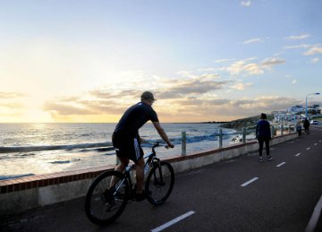
Cycling rules and tips
- Speed limits apply to cyclists! A 10 km/h speed limit applies to all vehicles travelling within City of Stirling parks (unless otherwise indicated by a sign). 10 km/h is about double walking speed
- Ride safely and courteously. When riding on shared paths, please be aware of pedestrians and other path users
- Give way to pedestrians at all times
- Keep left unless overtaking
- Ring your bell well in advance of reaching a pedestrian, to let them know you are behind them. Don't wait until you are close or you might startle them
- Be aware of roaming dogs.
Lake Gwelup Story Trail
Located within Mooro Country, home of the Wadjak Nyoongar people, Lake Gwelup Regional Open Space is an important natural and cultural place. Developed in partnership with the Rotary Club of Karrinyup, the Lake Gwelup Story Trail shares the area's Nyoongar culture, local history and rich biodiversity through a series of interpretive signs and public artworks.
The trail offers a unique opportunity to explore the stories, landscapes and wildlife of Lake Gwelup while learning about the people, places and traditions that have shaped the area over time.
As you walk along the trail, you'll encounter ground-based artworks created by local Nyoongar artists Emily Rose and David Jones, in collaboration with Jahne Rees. The artworks incorporate symbols and elements significant to Lake Gwelup, celebrating traditional knowledge, cultural practices and connection to Country. Together, the Story Trail and public art create an engaging cultural and educational experience for visitors.
The trail has been enriched by contributions from the local community and Wadjak Nyoongar people through community consultation. The trailhead was constructed in partnership with the Rotary Club of Karrinyup and the City of Stirling to celebrate the club's 50 years of community service.
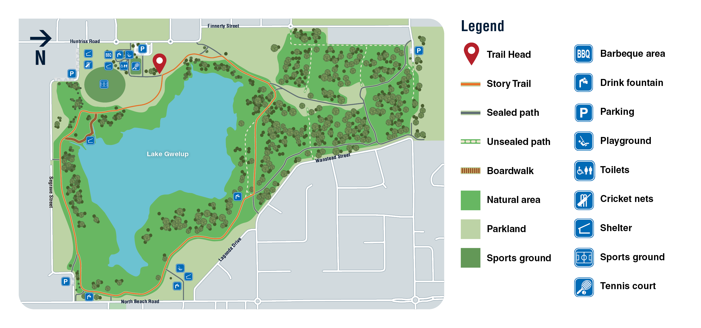
The trail is suitable for families and people with disabilities. The trail begins at the trailhead, which is close to the carpark off Huntriss Road.
- Distance: 2.4km
- Time: Approximately 90 minutes
- Trail classification: Class 1 (accessible).
.png "PRK_TrailHead_WebImages_Gwelup_1348x632px_AUG_26-(1).png")
To help protect Lake Gwelup Regional Open Space and ensure a safe and enjoyable experience:
- Stay on designated trails
- Carry drinking water, especially during warmer weather
- Take your rubbish with you
- Keep dogs on under control and pick up after your dog.
Trigg Bushland Story Trail
Discover the stories, landscapes and biodiversity that make Trigg Bushland Reserve one of the City's most significant natural areas.
Located within Mooro Country, home of the Wadjak Nyoongar people, Trigg Bushland Reserve is a 170-hectare Class A Reserve, Bush Forever site and State Heritage-listed area. The Story Trail offers a unique opportunity to explore the reserve's Aboriginal traditions, local history and rich biodiversity through a series of interpretive signs located along two walking loops.
The City thanks Ngalang Maya Wangkiny (Our Place Talking) Working Group, Friends of Trigg Bushland and local community members for providing valuable contributions in helping bring the Trigg Bushland Story Trail to life.
Explore the Trigg Bushland Story Trail through two walking loops, starting at Bournemouth Parade and Millington Reserve.
Dune Loop
The Dune Loop takes visitors through rare dune systems, colourful coastal heathlands and areas with panoramic ocean views. Along the way, discover stories of the people, plants and wildlife that have shaped and protected Trigg Bushland Reserve.
Start: Bournemouth Parade, Trigg
Distance: 2.7km
Allow: Approximately 1 hour 10 minutes
Ridge Loop
The Ridge Loop winds through banksia woodlands, tuart trees, and a limestone ridge, uncovering stories of Aboriginal culture, native wildlife and the reserve's rich biodiversity.
Start: Millington Reserve, Trigg
Distance: 2.9km
Allow: Approximately 1 hour 20 minutes
Download the trail map to help plan your visit.
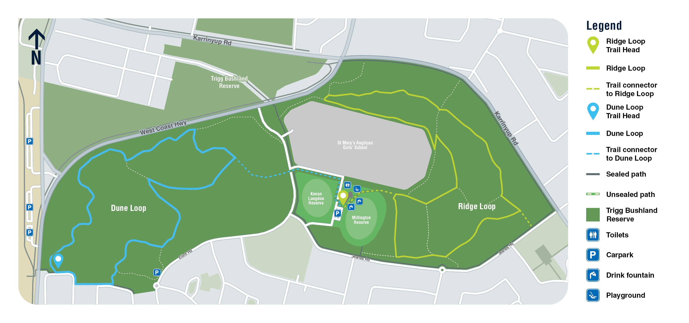
The Trigg Bushland Story Trail is classified as Class 3 (moderate). The trails are unsealed and include some steep inclines.
To help protect Trigg Bushland Reserve and ensure a safe and enjoyable experience:
- Stay on designated trails to protect native vegetation and wildlife
- Carry drinking water, particularly during warmer weather
- Toilets and drinking fountains are located at Millington Reserve
- Take your rubbish with you when leaving the reserve
- Keep dogs under control and pick up after your dog
- Download the trail map to help plan your visit.
The City of Stirling thanks Ngalang Maya Wangkiny (Our Place Talking) Working Group, Friends of Trigg Bushland and local community members for providing valuable contributions in bringing this story trail to life for everyone to enjoy.


