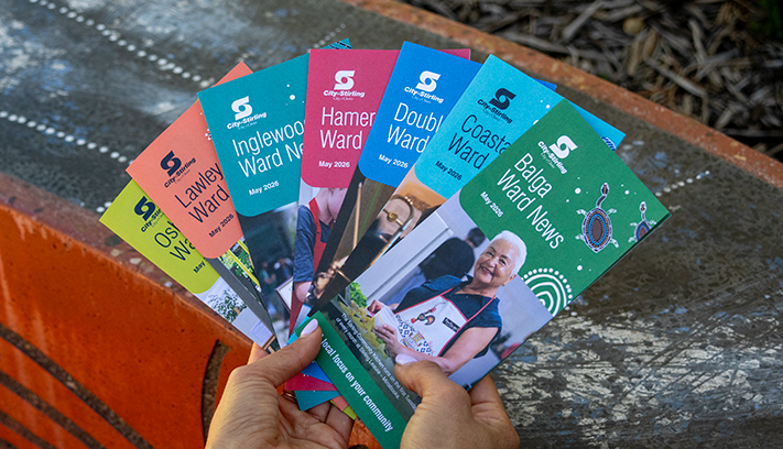
Future Stirling
Reviewing the Strategic Community Plan to guide the City’s long‑term direction.

The local community describes Innaloo as a central and friendly neighbourhood. To better understand what is means to be ‘a local’ our suburb profile seeks to understand the local stories Koora (past), Yeyi (present), Boordawan (future) and respond to Ngalang Maya (our place). This snapshot identifies the unique character of Innaloo’s neighbourhood and helps the City rethink how we deliver services with a local focus.
While the name Innaloo was adopted in 1927, it was originally referred to as Njookenbooroo, believed to be derived from the Aboriginal name for Herdsman Lake or a nearby swamp.
While the name Innaloo was adopted in 1927, it was originally referred to as Njookenbooroo, believed to be derived from the Aboriginal name for Herdsman Lake or a nearby swamp.
The area now known as Innaloo was originally part of land bought by Thomas Mews in 1831 and, while subdivision in northern Innaloo was approved in 1898, development lagged for many years. The southern section was subdivided in 1916 but again demand was not high. A map drafted in the early 1920s indicates only 10 houses had been built in the region with the majority of land used for grazing.
In 1915, the Education Department acquired land in the area and built the Njookenbooroo School on the north-east corner of Odin Road but the names of the school and post office were changed in 1927, at the request of the local progress association.
These are the top local priorities you've told us are important for Innaloo.
"Crime and drugs. There has been an increase in crime, mostly car thefts, open drug deals in the local parks, drugged out people at Morris Place. We need more investment in the community and infrastructure to deter this activity and behaviour."
The City currently operates 19 Ranger Service vehicles between 7.00am and 7.00pm, Monday to Sunday, with four Community Patrol vehicles operating 24/7, 365 days a year.
Through an election commitment of $80,000 the City has upgraded the CCTV at Morris Place Shopping Centre to provide more CCTV and assist WA Police Force.
The City, in partnership with other agencies, has established the Stirling Local Drug Action Team (SLDAT) and is now delivering a long-term Alcohol and Drug Plan 2025–2028.
Learn more about community safety initiatives in the City of Stirling.
"Make the Morris Place shops a nicer shopping precinct."
"Improve antisocial behaviour at Morris Place shops and surrounding areas."
The City is committed to working with business owners and the wider community to enhance Morris Place. A Business Convo was hosted on Tuesday 4 March 2025, where a number of priorities were identified by the local business community. The City has since responded to each priority and undertaken a lighting audit, targeted community safety patrols, a parking audit and landscape upgrades outside Stirling Leisure – Innaloo Community Centre have been completed. These upgrades include new garden beds, a landscaped seating area and tree planting.
As Morris Place comprises privately owned lots and a City-owned carpark, the City will continue to collaborate with local residents and business owners to enhance the shopping precinct. Through the 2025 State Elections the State Government $80,000 was committed to the City of Stirling to increase and upgrade CCTV at Morris Place Shopping Centre - this project has been completed.
Learn about the Business Convos program and community safety initatives in the City.
To make a report, call the City's Community Patrol on 1300 365 356 (24/7 services) or report online.
"Start making developers provide more parking at private dwellings so that there are less cars parked on the streets blocking line of sight."
"Traffic on Muir St towards Karrinyup Rd and the intersection."
As a high amenity residential area with access to parks and reserves, nearby retail and commercial uses and public transport, Innaloo provides an ideal location for increased housing supply and diversity to accommodate our growing population.
The State's Planning Codes provide parking requirements for residential development throughout Western Australia. As we plan for greater residential density to boost the supply and diversity of housing to accommodate our growing population, the City will continue to advocate for increased state funding of public transport options and infrastructure upgrades to reduce congestion.
The combination of increased residential density and state planning requirements to encourage greater public transport use can result in parking and traffic congestion issues in the short term. In response, the City continues to advocate for increased state funding of public transport options and infrastructure upgrades.
Muir Street is classified as a Local Distributor road and is expected to carry a certain volume of local and non-local traffic. The intersection of Karrinyup Road and Muir Street is the responsibility of Main Roads WA. Enquiries should be directed to 138 138 or enquiries@mainroads.wa.gov.au.
"Parking. With houses being knocked down and three or four units going up on the same block, streets are overcrowded with cars."
The State's Planning Codes provide parking requirements for residential development throughout Western Australia. As we plan for greater residential density to boost the supply and diversity of housing to accommodate our growing population, the City will continue to advocate for increased state funding of public transport options and infrastructure upgrades to reduce congestion.
The combination of increased residential density and state planning requirements to encourage greater public transport use can result in parking and traffic congestion issues in the short term. In response, the City continues to advocate for increased state funding of public transport options and infrastructure upgrades.


Extensive development in the area began in the 1940s with street names taken from Greek mythology and the passenger list from the ship Rockingham. Residences in Innaloo are primarily single detached homes, built around the time of World War Two. Most are of timber-frame construction and reflect post-war design standards.
Innaloo also contains a scattering of duplex homes and recently built units, which are gradually replacing older housing stock. The majority of these newer dwellings are of brick and tile construction and have a modern design.
The Stirling City Centre (part of the Stirling Regional Centre) contains commercial and retail facilities, servicing the local population and surrounding region. This commercial area includes Westfield Innaloo Shopping Centre and forms a focal point for the suburb. Originally built in 1967, it was one of the first large-scale suburban shopping centres in the metropolitan area.
Located on Scarborough Beach Road, the Stirling City Centre includes shopping and community facilities, as well as restaurants and a cinema complex in neighbouring Woodlands. Innaloo also contains a local shopping centre on Morris Place that provides for the daily needs of residents.
Innaloo has 13 local open spaces, two community open spaces and two district open spaces, amounting to 18ha of public open space. Birralee Park contains a range of sporting facilities and Yuluma Park offers lawn bowls and tennis. The area is also home to a recreation centre and 2 primary schools serving educational needs.
City of Stirling kaadatj Nyoongar moort Nyoongar boodja-k Wadjak boodja-k. Ngalak kaadatj Nyoongar nedingar wer birdiya koora koora wer yeyi. Baalabang koondarm, malayin wer nakolak baalap yang ngalany-al. Ngalak dandjoo barn wer kaaratj bandang boodja-k.
The City of Stirling acknowledges the traditional custodians of this land, the Wadjak people of the Nyoongar Nation, and pays respect to the Elders both past and present for they hold the memories, the traditions, the culture and hopes of Aboriginal Australia.


.jpg)