28 November 2025
Next steps for coastal boardwalk
Following a resolution at the Council Meeting on 25 November 2025, the coastal boardwalk will proceed to the next phase.

30 July 2025
30 August 2025
Last update date: 16 April 2026
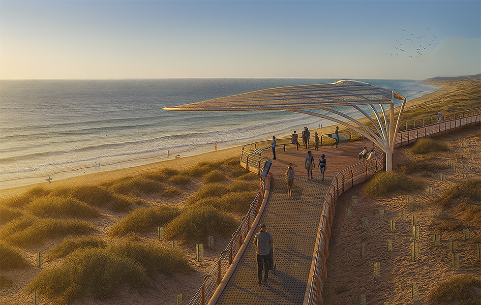
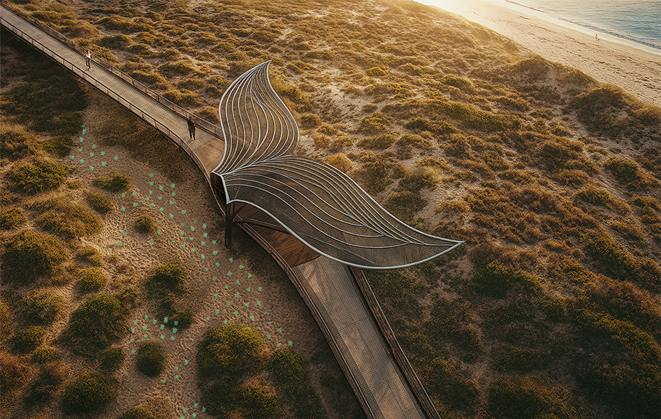
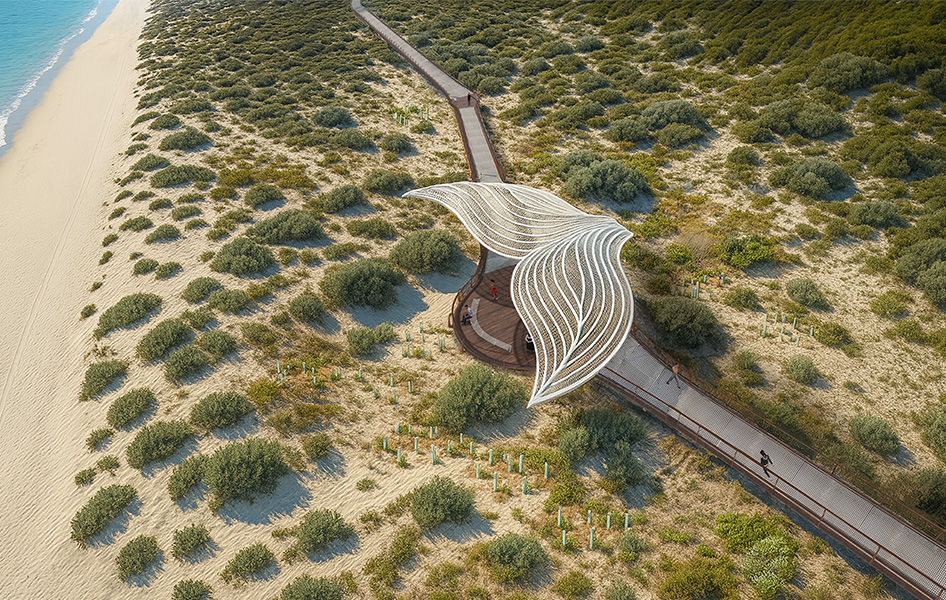
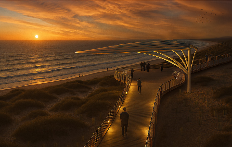
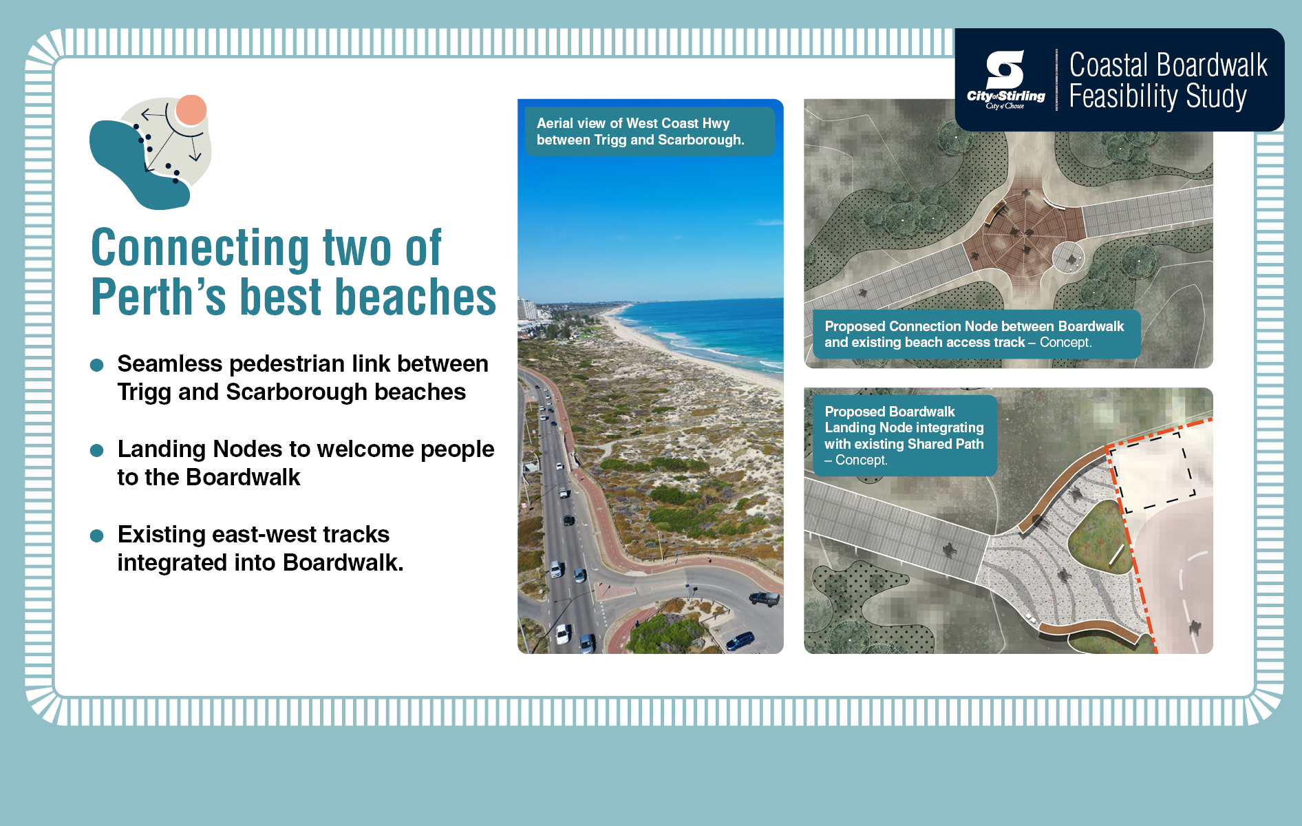
The Coastal Boardwalk Concept Consultation was undertaken from 7.00pm 30 July to 7.00pm 30 August 2025, inviting feedback on design concepts for a coastal boardwalk between Scarborough and Trigg.
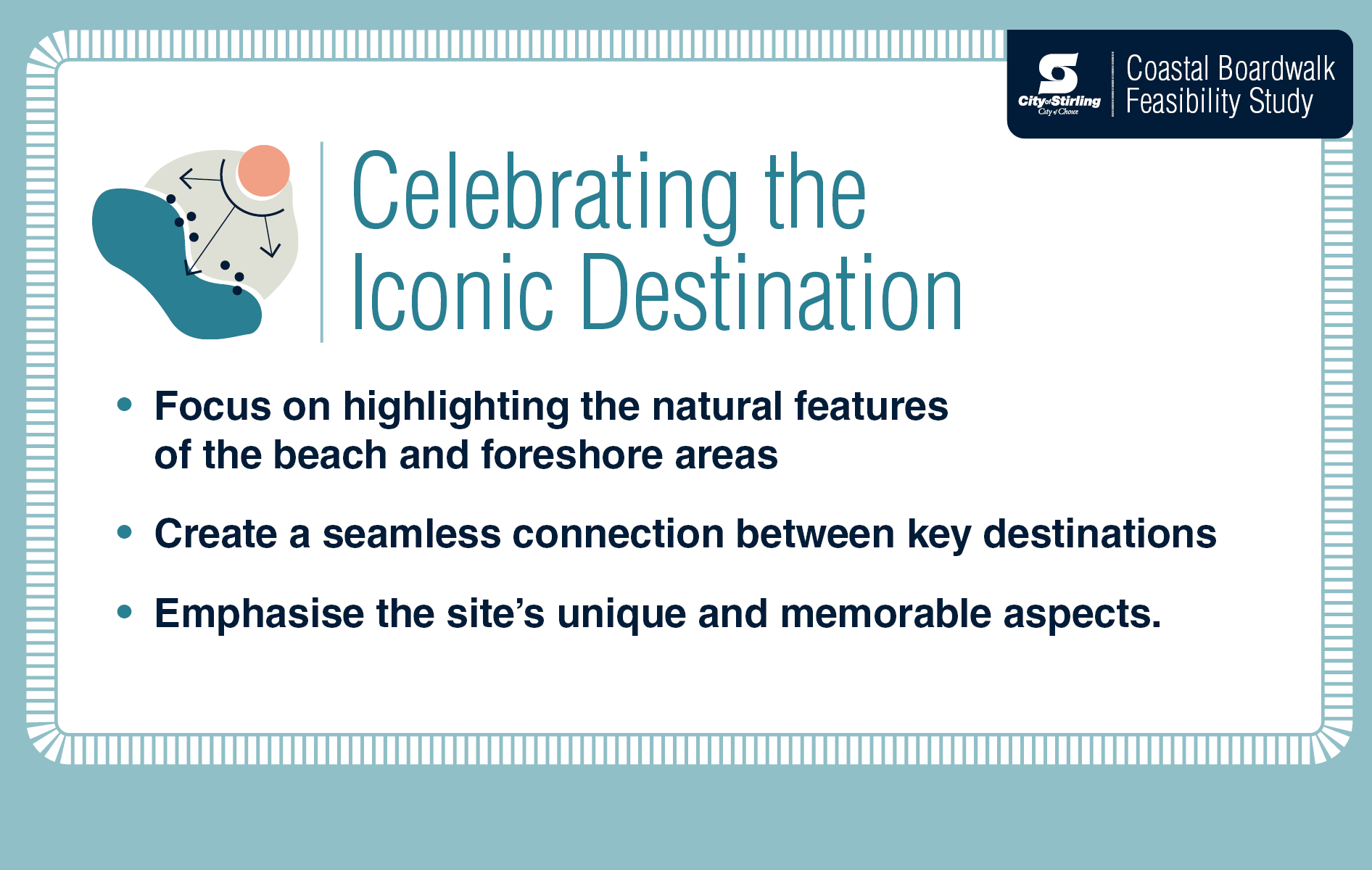
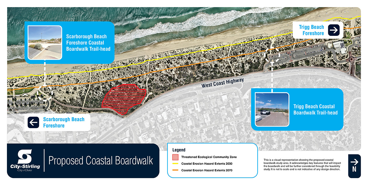
This consultation formed part of the broader feasibility study, which is assessing the viability of constructing a boardwalk in the South Trigg Beach Reserve.
The proposal aims to:
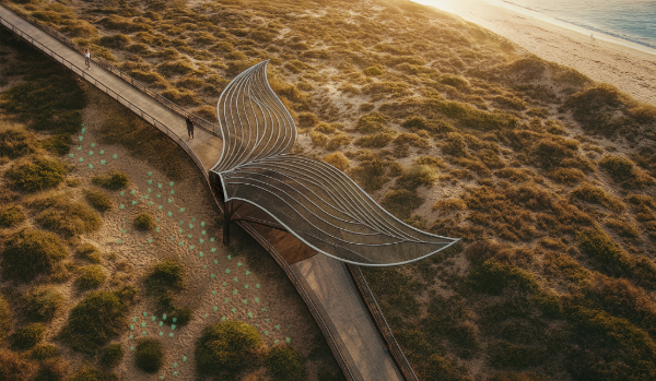
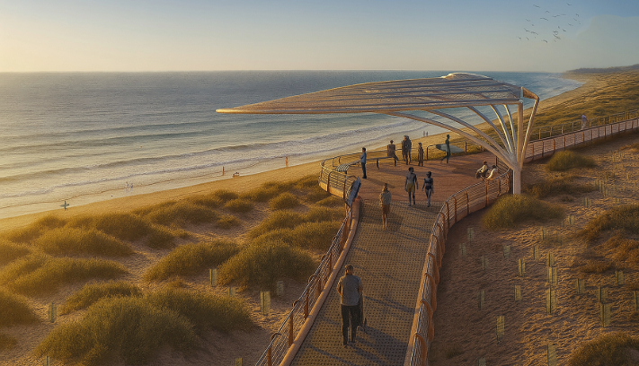
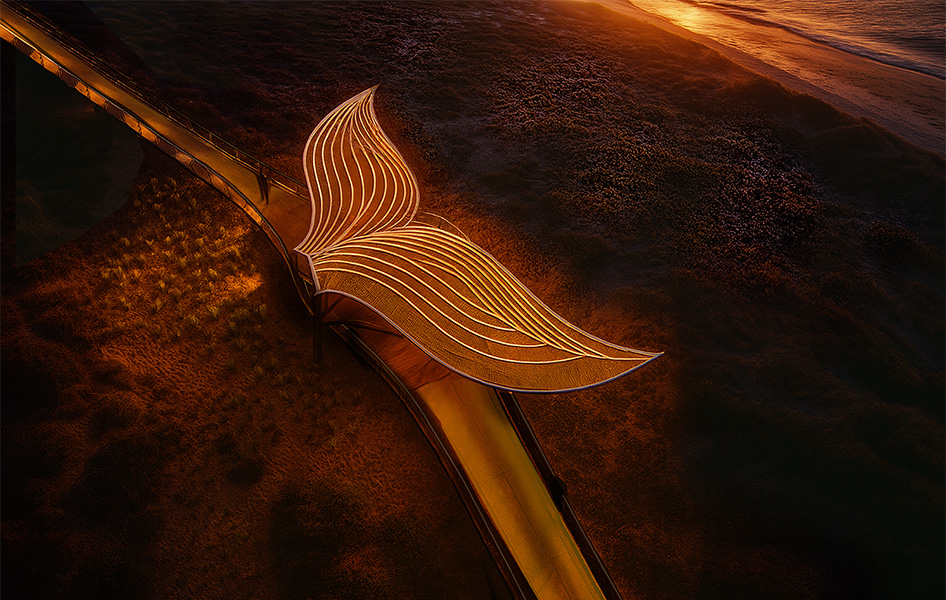
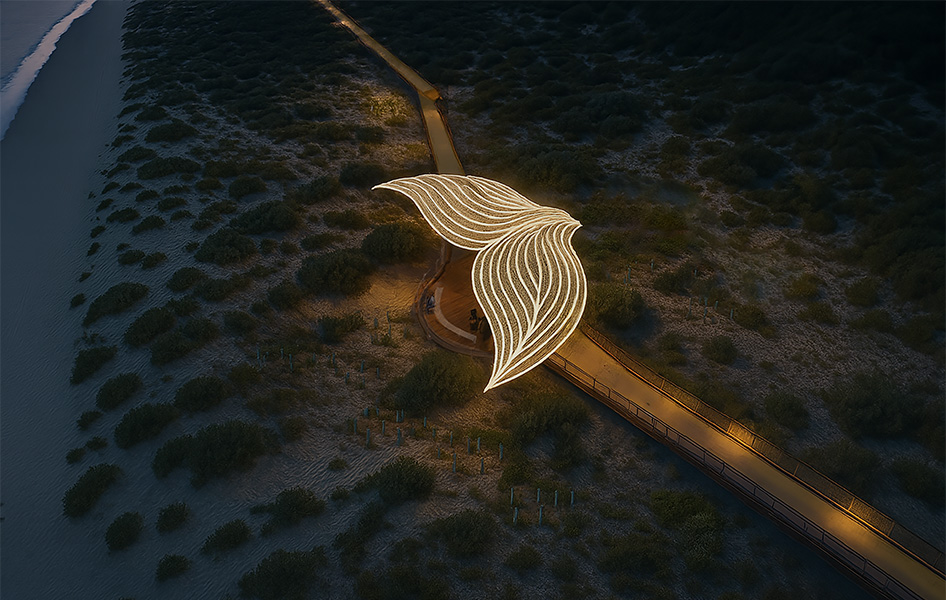
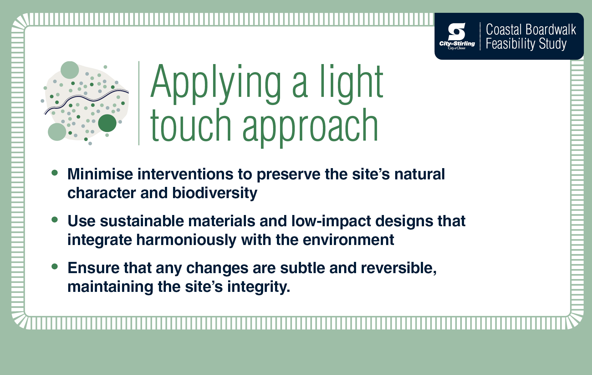
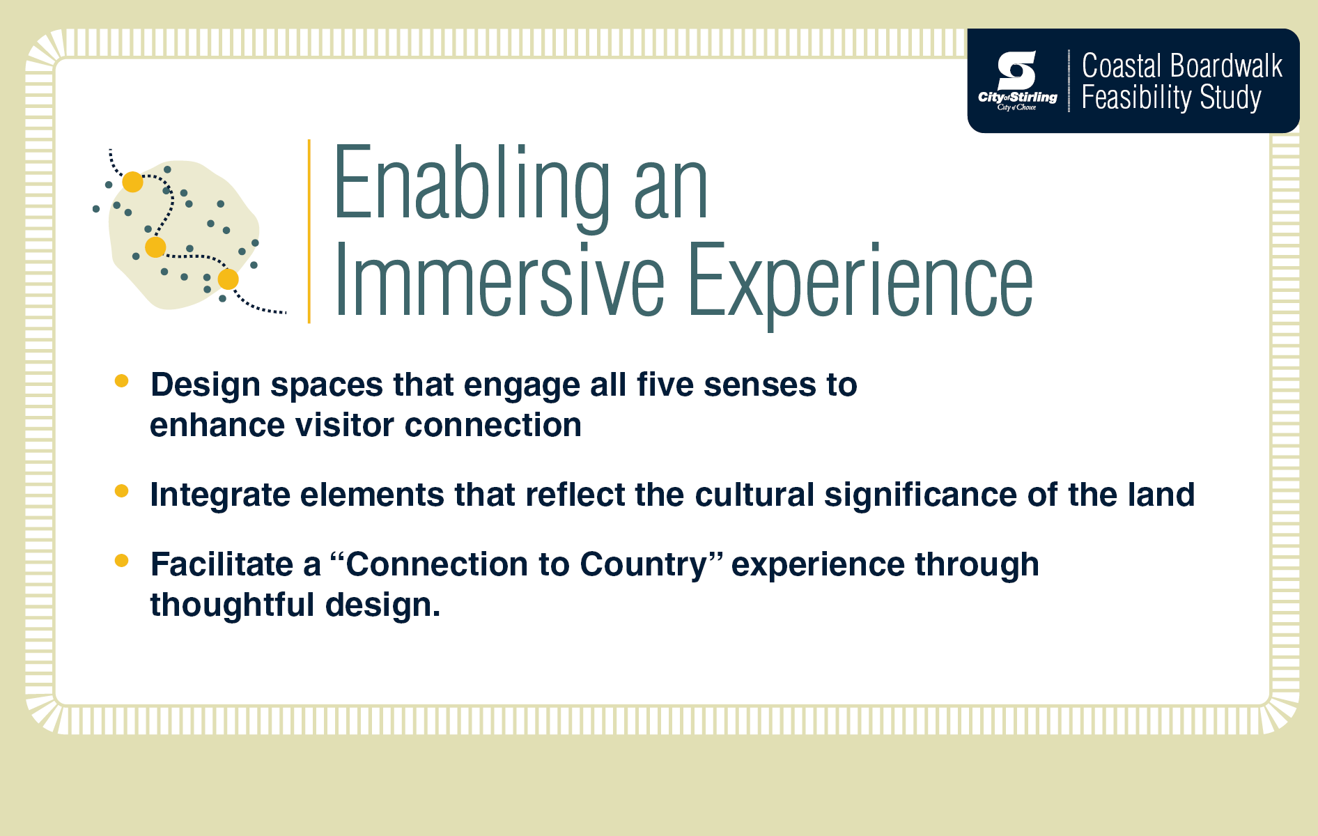
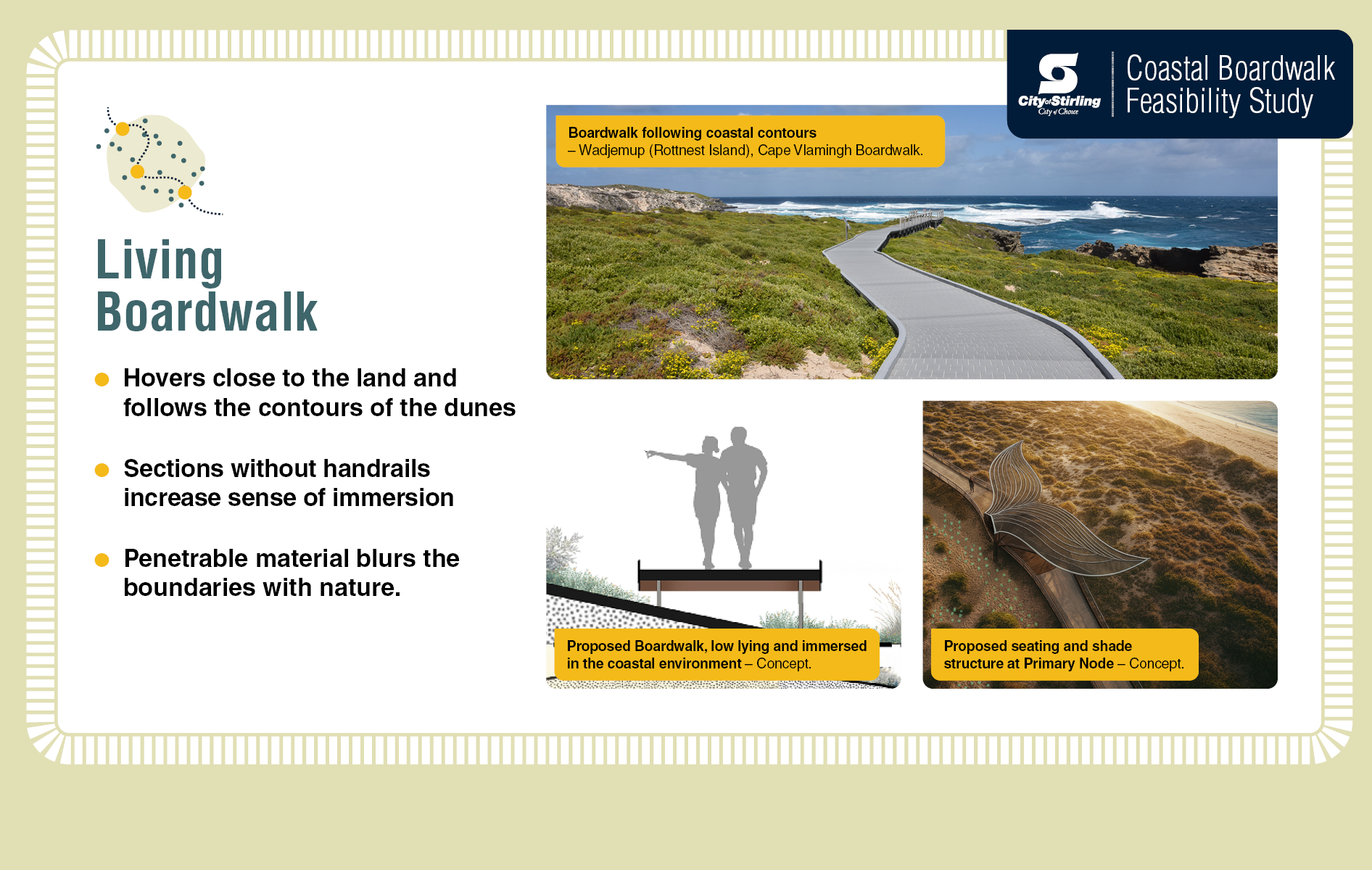
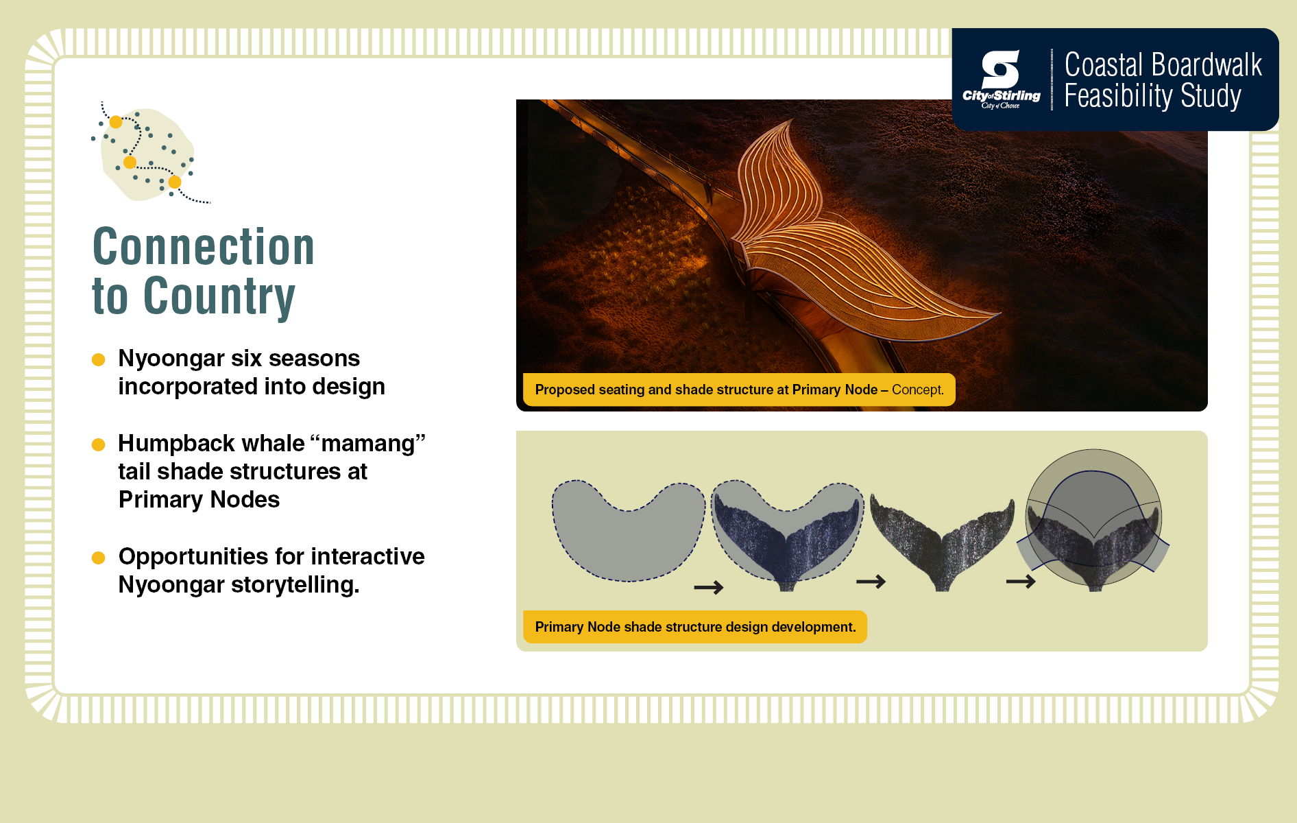
The design concepts were guided by three core principles: applying a light touch, celebrating the iconic location, and enabling an immersive experience for users. These principles were shaped by independent environmental surveys, engineering advice, and initial stakeholder engagement.
During the consultation period, the community had opportunities to learn more about the proposal including through information and drop-in sessions.
A total of 2,499 verified submissions were received, with 70% in support and 30% objecting. This level of participation ensures that a wide range of views are considered, helping to shape a deeper understanding of what's important for the proposal. Key feedback themes raised by the community include improved pedestrian safety, enhanced accessibility, general support, environmental impact, and cost concerns.
A summary of feedback and detailed analysis is available in the Consultation Outcomes Coastal Boardwalk Concept Consultation.
View the minutes from the Council Resolution on 25 November 2025 and the separate attachments.
• Preliminary environmental opportunities and constraints assessment commenced
• Preliminary environmental opportunities and constraints assessment report is released to community.
• Environmental surveys are collected
• Preliminary design concepts are developed
• Construction methodologies and techniques are explored
• Initial cost assessment are prepared.
• Coastal Boardwalk Concept Consultation
25 November 2025
View more

The proposal to construct a coastal boardwalk between Scarborough and Trigg beaches has been considered by Council in 2005 and 2013. The minutes of these meetings are attached below.
In 2005 it was decided that given the results of the community and stakeholder consultation processes the Council would take no further action on the boardwalk at that time.
In 2013 when the matter was considered by Council, Officers made a recommendation to proceed with the detailed design brief for the preferred route that would consider the comments and concerns received during the consultation. This recommendation was supported by the Committee, but the motion was not supported at the Council meeting held on 3 September 2013.
In more recent years, there have been three Notice of Motions relating to the idea of a Coastal Boardwalk presented to Council: two by Cr Felicity Farrelly on 27 April 2021 and 15 February 2022, and another by Cr Rob Paparde on 5 December 2023 to consider a proposal at an Elected Member workshop, which then went ahead in March 2024. The minutes of those Council Meetings can also be found under Useful Documents below.
The City appreciates the ongoing community interest in the coastal boardwalk feasibility study. These FAQs were intended to provide clarity around the Coastal Boardwalk Concept Consultation.
When was the consultation period?
From 30 July to 30 August 2025.
What was the purpose of the consultation?
The consultation offered opportunities for the community to learn more about the proposal and provide feedback on design concepts to be considered in the decision-making process.
How was the consultation undertaken?
In accordance with the City’s Community Engagement Policy, which can be found here. This policy outlines the commitment of consultation to listen to our community’s feedback on the proposal and consider their views in our decision.
How was feedback provided?
Feedback was submitted via the City’s online Community Consultation Submission Form. Those seeking an alternative format or needing support to complete a submission, were able to contact the City on (08) 9205 8555.
How was information shared?
In line with consultation procedures, the project has a designated webpage, related news articles, and had onsite signage. Flyers were distributed throughout Scarborough and Trigg, and letters sent within a 400-metre radius of the proposed site. The City hosted informal drop-in sessions as well as an information session on 10 August.
Who could provide feedback?
All stakeholders were welcome to participate. The City’s Community Consultation Submission Form accepted submissions from individuals both within and outside the City.
What data quality measures are being implemented?
All submissions received by the City of Stirling were verified using the provided address and data quality procedures consistent with best practice were undertaken.
How will Council review and interpret submissions?
The outcomes of the consultation are summarised in a table, which outlines levels of community support and opposition based on proximity to the project location. This approach provides consistency in how submissions are reviewed and interpreted by Council.
How will consultation outcomes be shared with the community?
A summary of feedback and detailed analysis is available in the Consultation Outcomes Report under Consultation Documents below. The City will now take time to review the feedback in detail, as part of the ongoing feasibility study and decision-making process.
Community feedback on the design concepts will be considered in the decision-making process.
In 2024, we invited community members to submit questions about the proposal through this webpage. Below, you'll find responses to the most frequently asked questions.
Will special interest groups be engaged?
We are committed to working closely with all groups via extensive consultation, including the Nyoongar community, special interest groups and locals.
How will the community be kept informed and can provide feedback?
We will provide upddates via the City's project webpage, Facebook page and our newsletters. We will consult the community and stakeholders and keep you informed as we progress through key stages of the project.
Why is $500,000 required for a feasibility study?
The Coastal Boardwalk Feasibility Study includes funds for an independent environmental impact assessment, an economic study, developing design options and community consultation.
Why is it taking so long?
The City is aware proposals have been raised since 2005. We want to ensure a thorough, open and transparent process, which can take time.
How is the City considering coastal hazards like erosion and inundation?
The City has prepared a Coastal Hazard Risk Management and Adaptation Plan to enable long-term management of areas that may be impacted by coastal hazards. The CHRMAP will be used to inform the environmental considerations for this project.
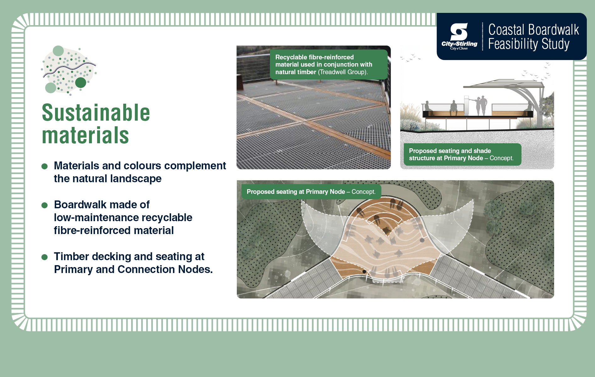
What would a Coastal Boardwalk be made of?
If the project proceeds beyond the feasibility study, consideration will be given to materials that are eco-friendly and sustainable. The different types of materials and products available will be further explored through the concept design stage.
Will it be for pedestrians only?
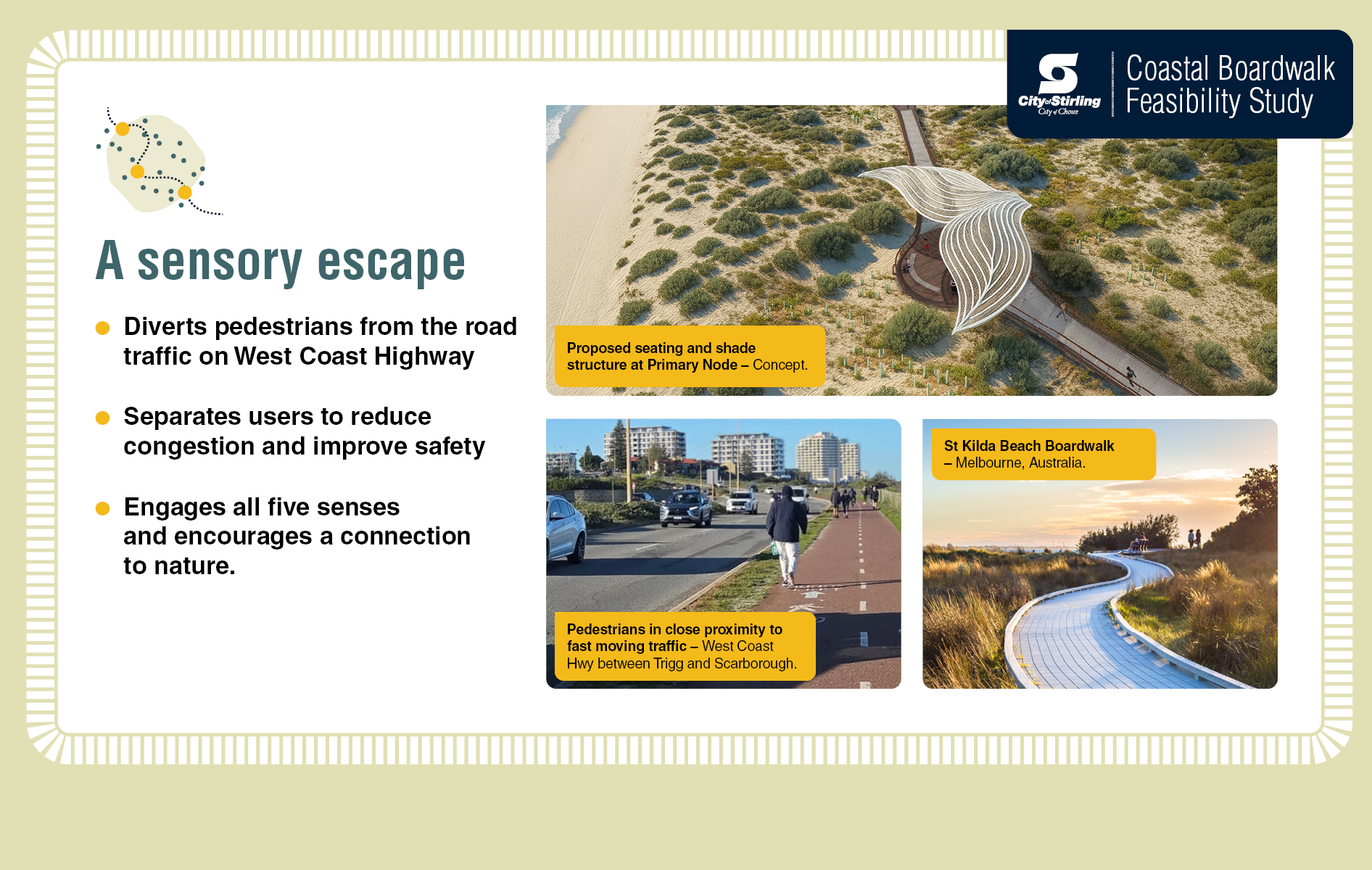
As part of community consultation for the project, the City will welcome feedback from the community on how they would like the boardwalk to be used. With the continuing popularity of bikes and e-rideables, along with increasingly high levels of recreational users on the existing path, pedestrian safety perceptions are decreasing. Feedback will inform consideration of the future use of a coastal boardwalk.
Is upgrading the existing pathway an option?
Like a coastal boardwalk, upgrading the existing pathway would involve works through the Class A reserve and would be subject to a high level of scrutiny. The City is focused on understanding the potential environmental impacts of all options.
What considerations are being given to car parking?
One aim of an economic study is to estimate foot traffic and increased visitation to the area.
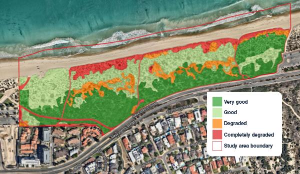
What considerations are being given to the site’s environmental status?
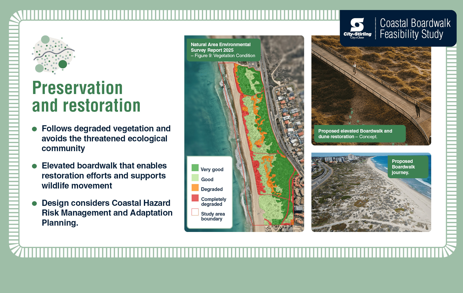
The South Trigg Beach Reserve is classified as an A class reserve under the Land Administration Act 1997, as well as a Bush Forever Area - Number 308. We also note that the reserve is Sector 6 of the Trigg Bushland Reserve and features Quindalup Dunes, including Callitris preissii (or Melaleuca lanceolata) Forests and Woodlands of the Swan Coastal Plain Threatened Ecological Community. Class A reserve status does not necessarily prohibit all works, particularly properly managed and controlled paths providing access and enjoyment. This Coastal Reserve is protected by legislation which requires a high level of scrutiny and will require appropriate design solutions to meet environmental conditions. Additional environmental requirements will be considered as part of the project including the City’s Coastal Hazard and Risk Management Adaptation Plan (CHRMAP), Trigg Bushland Reserve Management Plan and relevant State and Federal Government approvals.
In 2024, we invited community members to submit questions about the environment through this webpage. Below, you'll find responses to the most frequently asked questions.
What considerations are being given to the proposed location in an environmentally sensitive area and erosion zone?
The Preliminary Environmental Opportunities and Constraints Assessment Report references that the South Trigg Beach Reserve is classified as an A class reserve under the Land Administration Act 1997, as well as a Bush Forever Area - Number 308. We note that the reserve is Sector 6 of the Trigg Bushland Reserve and features Quindalup Dunes, including Callitris preissii (or Melaleuca lanceolata) Forests and Woodlands of the Swan Coastal Plain Threatened Ecological Community. These classifications provide extra protection and approval requirements, however, do not prohibit all works, particularly boardwalks and paths that provide access and enjoyment. Aligning with the City’s Coastal Hazard Risk Management and Adaptation Plan, the report recommends that the boardwalk should be mostly situated to the east of the 2070 coastal erosion hazard extent.
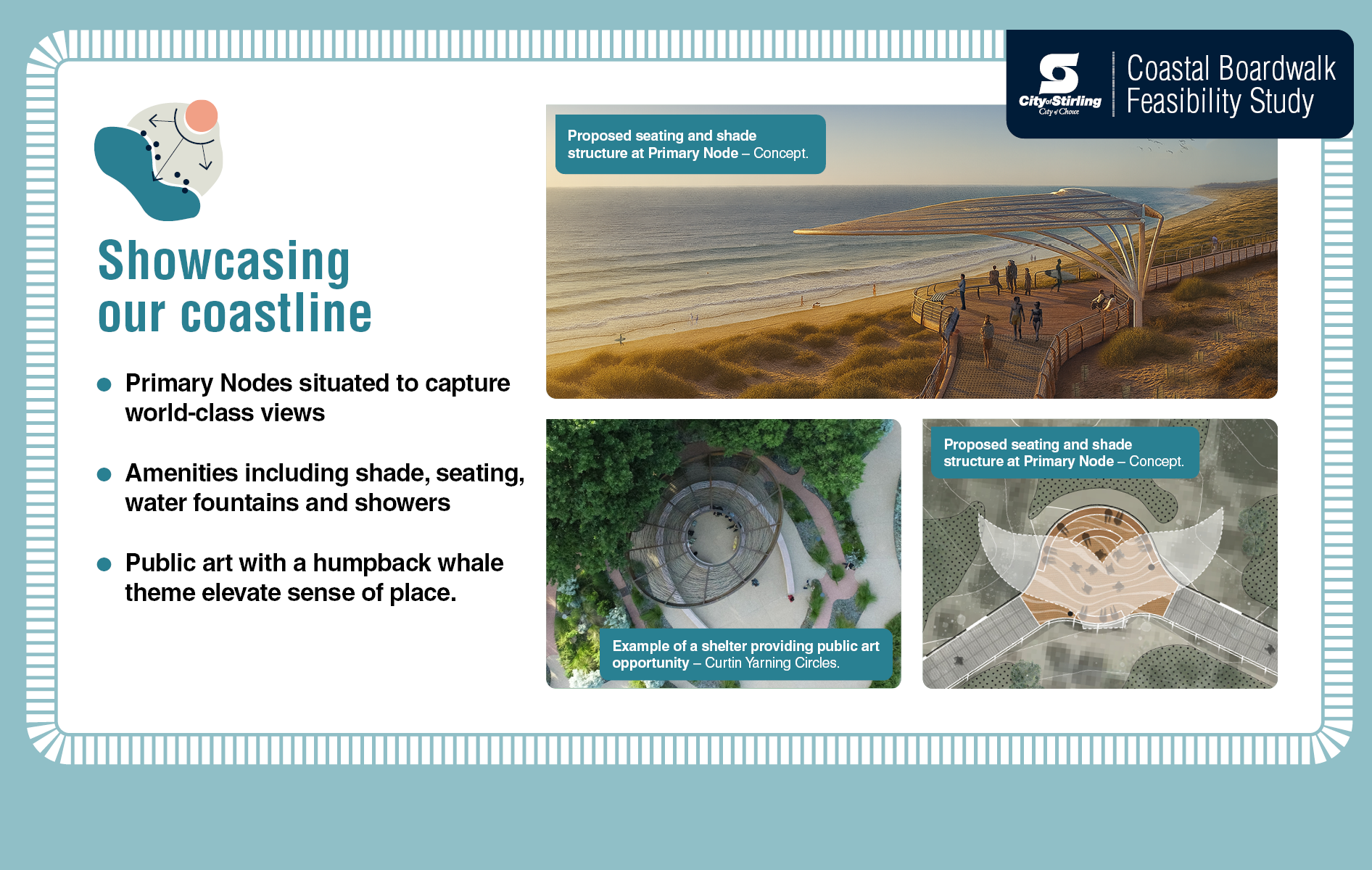
Will a boardwalk hinder the current views of the ocean and horizon?
The assessment notes that the boardwalk would provide a unique opportunity to showcase the visual amenity of the area. It recommends that a drafted design is evaluated by an independent landscape architect or visual amenity specialist from various viewpoints and nearby residential areas. Those considerations should inform the siting of lookout points along the boardwalk. Careful positioning and material selection for the boardwalk will be paramount to minimise visual intrusion.
How would the dune ecosystem, flora and fauna be protected during construction?
The study suggests that the design process avoids places of unique landscape and scientific significance including the Callitris preissii (or Melaleuca lanceolata) Forests and Woodlands of the Swan Coastal Plain Threatened Ecological Community. One of the highest recommended priorities is minimising vegetation disturbance during construction, with a suggestion to engage a landscape architect and engineer to provide specialist advice. If unavoidable, disturbed areas should be rehabilitated with native species, noting that successful revegetation works have occurred within the area. The report references the Trigg Bushland Reserve Management Plan and recommends further studies include a flora and vegetation survey, fauna survey and land quality assessment. It notes that a Native Vegetation Clearing Permit will be required.
How will you control foot traffic, manage rubbish, and protect the safety of walkers especially at night?
The report recommends controlling public access through fencing or balustrading, citing examples of other boardwalks in similarly environmentally sensitive areas, often used to control access and protect the natural environment while showcasing the area. It states that litter does not pose a constraint to the boardwalk but recommends consideration of providing rubbish bins. Another consideration is passive surveillance of the area such as CCTV.
How will you control costs of building and maintaining the structure, including carparks?
An economic study will likely consider many factors including estimated foot traffic and increased visitation to the area to inform parking considerations.
What about the environmental buffer?
The Trigg Bushland Reserve Management Plan recommends, though does not mandate, a buffer of at least 50 metres around the Callitris preissii (or Melaleuca lanceolata) Forests and Woodlands of the Swan Coastal Plain Threatened Ecological Community (TEC). The Plan notes that a buffer cannot be established in all locations due to existing development, such as the area to the south east in Sector 6. The Preliminary Environmental Opportunities and Constraints Assessment recommends that where possible the boardwalk design should be setback approximately 15 metres from the TEC. It should also be fenced prior to construction to provide additional protection from potential direct impacts. The buffer to the TEC should be reassessed when the exact extent of the TEC is known.
What considerations are being given to lighting?
While lighting can significantly enhance safety and visibility, it is essential to balance this with the need to protect the natural environment, and this forms part of considerations.
The consultation period, from Wednesday 30 July to Saturday 30 August, is offering opportunities for the community to learn more about the proposal. Community members are invited to attend an information session and informal drop-ins, with details available on this page.
The Preliminary Environmental Opportunities and Constraints Assessment Report, by consultancy Coterra Environment, provides independent advice to balance the consideration of designing and constructing a coastal boardwalk in the South Trigg Beach Class A Reserve No. 46248.
The area is classified as a Class A Reserve under the Land Administration Act 1997 and a Bush Forever Area. Class A Reserve status does not prohibit all works, particularly boardwalks and paths that provide access and enjoyment.
Please see the preliminary environmental assessment under useful documents at the bottom of this page.
For more information, or to receive this information in an alternate format, please contact the City on (08) 9205 8555 or visit www.stirling.wa.gov.au/enquiry.
City of Stirling kaadatj Nyoongar moort Nyoongar boodja-k Wadjak boodja-k. Ngalak kaadatj Nyoongar nedingar wer birdiya koora koora wer yeyi. Baalabang koondarm, malayin wer nakolak baalap yang ngalany-al. Ngalak dandjoo barn wer kaaratj bandang boodja-k.
The City of Stirling acknowledges the traditional custodians of this land, the Wadjak people of the Nyoongar Nation, and pays respect to the Elders both past and present for they hold the memories, the traditions, the culture and hopes of Aboriginal Australia.